What Is Sediment Profile Imaging (SPI)?
Sediment Profile Imaging (SPI)
One of the Sediment Profile Imaging (SPI) camera’s most powerful attributes is its ability to convey ecological information in a format that most people can understand quite easily: a picture.
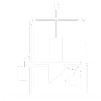
Sediment Profile Imaging (SPI) technology has been used extensively internationally and throughout the United States. For the past 40 years, SPI has been used to monitor the environmental impacts of dredged material disposal, to characterize sediment quality, to monitor the impact of construction activity on the seafloor, and to search for pollution “hot spots”. This optical coring device works like an upside-down periscope and takes cross-sectional images of the upper 20 cm of the seafloor.
As one of the developers of the technology, we had the privilege of introducing it to the government of Hong Kong in 1993, and it became a key component of the four-year, territory-wide monitoring program associated with the massive dredging/land reclamation that was a key aspect of the new Chep Lap Kok airport construction. We introduced the technology in many areas outside of the United States, including Canada, Ireland, Italy, New Zealand, China, and Azerbaijan. SPI is a powerful technology that provides an innovative and cost-effective solution to many marine environmental monitoring programs.

What Sediment Profile Imaging can Measure
Sediment Profile Imaging allows rapid data acquisition during field sampling (the camera is literally “pogo-sticked” across the seafloor). A wide variety of physical and biological parameters can be measured from each image.
- Grain-size major mode and range (gravel, sand, silt, clay).
- Small-scale surface boundary roughness.
- Evidence of erosional or depositional environments, allowing identification of high and low kinetic energy areas.
- Subsurface methane gas pockets (evidence of high Sediment Oxygen Demand).
- Depth of the apparent Redox Potential Discontinuity (RPD).
- Calculation of the Organism-Sediment Index, allowing rapid identification and mapping of disturbance gradients in surveyed areas.
- Presence of epifauna.
- Surface microbial aggregations.
- Infaunal Successional Stage.
- Evidence of excess organic loading and high sediment oxygen demand.
Benefits of using Sediment Profile Imaging
Because traditional seafloor sampling techniques are expensive and time consuming, an efficient sampling strategy for surveys can be an enormous aid to completing an efficient survey. SPI aids in determining the location of traditional sampling stations by rapidly characterizing the variation in benthic sedimentary and community conditions. Limited sampling resources can be allocated to the optimum sampling locations to accurately characterize the variance that exists in a particular area. All too often the results of monitoring programs reveal that a particular parameter of interest has either been over- or under-sampled as a result of “flying blind” initially and then sticking with the initial station locations that were arbitrarily selected from a nautical chart.

Rapid and cost-effective data collection and analysis
Large areas of seafloor can quickly and efficiently be surveyed with SPI. For many monitoring objectives, SPI technology can provide the necessary answers without the need to collect grab samples or to repeatedly enumerate and identify individual invertebrates and assemble long species lists each time a sampling study is performed.
Gradient delineation between sampling locations accurately
Because the SPI camera can obtain pictures rapidly and efficiently, it can supplement traditional sampling methods. SPI achieves this by “filling in the gaps” between traditional chemical and biological sampling locations. The camera can accurately delineate gradients in biological community type, organic loading, or sediment grain-size between fixed station locations.

Results that are easily understandable to a non-scientific audience
Many environmental programs have suffered because of their inability to convey results to regulators or a public audience who may lack a marine science background. One of the camera’s most powerful attributes is its ability to convey ecological information in an easily understandable format: a picture.
Over the past 10 years, we have come to realize that SPI technology’s most powerful asset is this ability. SPI was able to provide the decisive evidence in several environmental litigation cases concerning ocean disposal impacts. SPI technology proved that impacts were transitory and that a full ecosystem recovery had occurred.
Learn more about SPI by visiting our downloads library:
Downloads Library